
Major global coffee companies and commodity traders have launched a satellite-based monitoring system to track deforestation linked to coffee farming, marking a significant step toward more transparent and sustainable supply chains. The initiative, known as the Coffee Canopy Partnership, brings together firms such as JDE Peet’s, Tchibo, and Louis Dreyfus Company, as reported by Reuters.
The system combines high-resolution satellite imagery from Airbus with artificial intelligence to map coffee farms and detect nearby forest loss. By improving the accuracy of land-use data, the platform aims to identify deforestation risks, support restoration efforts, and provide reliable insights for governments, companies, and farmers.
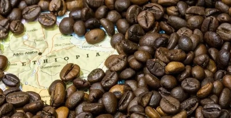
The programme will initially focus on East African coffee-producing countries including Ethiopia, Kenya, Uganda, Tanzania, Burundi, and Rwanda, before expanding globally by 2027, GlobeNewsWire noted. The pilot phase alone is expected to map over 1.2 million square kilometres of coffee-growing landscapes.
The initiative is also a response to tightening environmental regulations, particularly the European Union’s deforestation rules, which require companies to prove that commodities like coffee are not sourced from recently deforested land. Industry players say more precise mapping is essential to avoid misclassifying sustainable farms as deforested areas, a risk that could exclude millions of smallholder farmers from global markets.
Overall, the launch signals a broader shift toward data-driven sustainability in agriculture, where satellite technology and AI are becoming critical tools in balancing environmental protection with the livelihoods of farmers across developing regions.
